SEPTEMBER 2019
 |
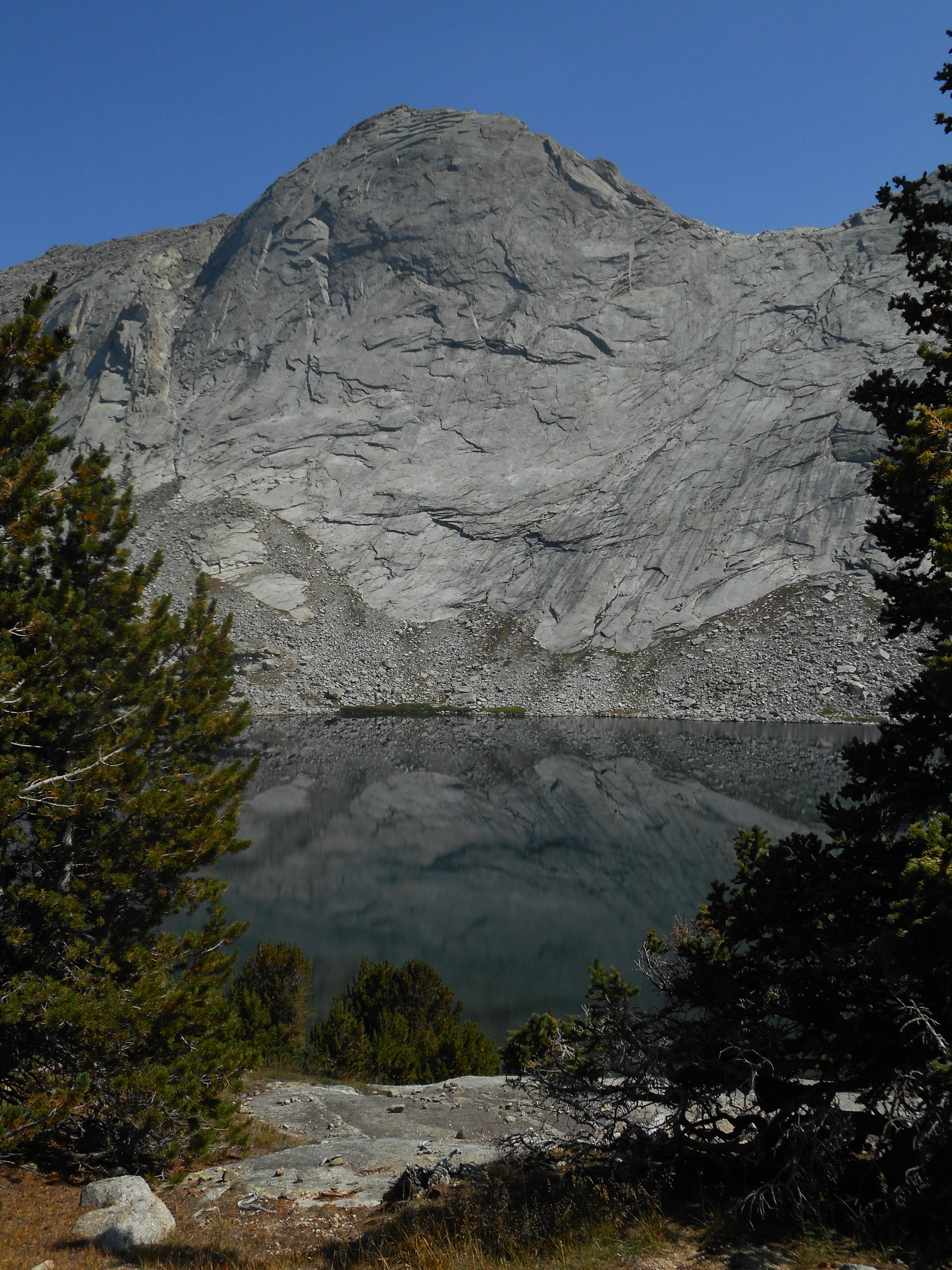
| MOUNT HOOKER |
 |
| MOUNT HOOKER |
 |
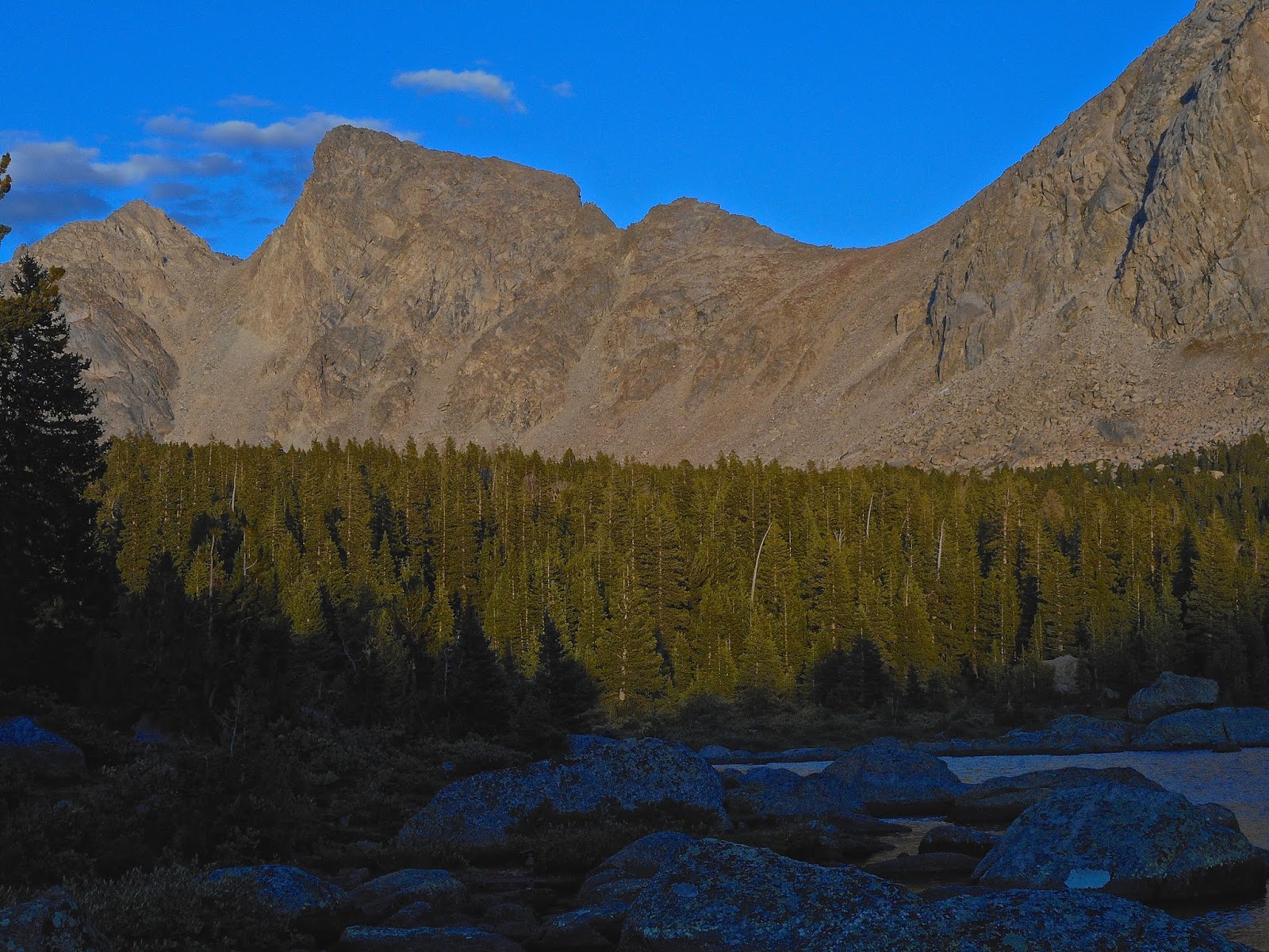
| BAPTISTE LAKE |
 |
| BAPTISTE LAKE |
 |
| MAYS LAKE |
 |
| AMBUSH PEAK |
 |
| AMBUSH VALLEY |
 |
| AMBUSH VALLEY |
 |
| ENTERING AMBUSH VALLEY |
 |
| AMBUSH VALLEY "M" |
 |
| RAID PEAK |
 |
| SHADOW LAKE |
 |
| SHADOW LAKE |
We began our hike to Mount Hooker at the Big Sandy Trailhead, near the town of Boulder, Wyoming. To get to Mount Hooker, you will take a left near the beginning of the trail to leave the Big Sandy River and follow the Continental Divide Trail past Dads Lake and Marms Lake. After about eight miles, you will come to Washakie Creek. We decided to take a right at Washakie Creek, and set up camp along the creek before running up to check out Shadow Lake before it got dark. We actually did run most of the way to the lake trying to get there before it got too dark. Shadow Lake is amazing, and we were able to get some good shots of it, and then decided to run up to Billys Lake, only about a half-mile further up. We got here just as it was starting to get dark. I really loved this area, and wished we had more time to explore, as there are two more lakes just above Billys Lake that look like they would amazing. These lakes are all located just behind the Cirque of the Towers, so they have a really stunning backdrop. After checking out Billy's we hiked back to our campsite in the dark using headlamps and flashlights.
The next morning we continued up the trail past Skull Lake and Mays Lake, and set up camp at Pyramid Lake. Once set up, we day-hiked over to Ambush Valley to check out the lakes and peaks there. This area was amazing. I really enjoyed the views approaching this valley, and visiting the lakes along the base of the mountains.
The next morning, we packed up and hiked down to Mays Lake, where we hid our packs along the trail and and day-hiked up through Haily Pass. It wasn't too bad of a hike up to Haily Pass from Mays Lake, and there a couple nice lakes located near the top. However, the drop down from Haily Pass to Mount Hooker was pretty brutal. This was a very steep drop, with no official trail. There were some paths to follow, but they were a bit rough. Once down, it was also some tough going to get to the lake at the base of Mount Hooker. There was no trail, and the area was covered in rocks, boulders and bushes, which made it difficult to maneuver through.
The view was amazing once we made it to the lake. From here we decided to hike up to Baptiste Lake, which was a long, steep climb over some boulders. The views at Baptiste Lake were amazing. After enjoying the area, we found a trail along the outlet to Baptiste Lake that took up most of the way back to Haily Pass. We then continued down the trail to Washakie Creek where we spent our last night before returning to the trailhead.